
The Effingham Parkway is still a few years away from construction, but the interest in the road isn’t stuck in neutral.
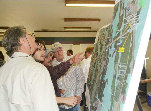
Dozens of Effingham County residents pored over the maps and schematics of the proposed roadway Wednesday evening, including many whose property stands in the way of the projected route.
The current concept, County Administrator Toss Allen said, is a two-lane road from Highway 30 to Blue Jay Road, and the goal is still to find a way to alleviate the congestion on Highways 21 and 80. The solution, though, isn’t around the corner.
“We’re still a few years away,” Allen said of the $46 million project.
Building the road could take two to two-and-a-half years, Allen added, and no start date has been identified. That didn’t deter scores of citizens from inspecting the maps and filling out comment forms.
“People are definitely interested,” said county commission Chairman Wendall Kessler, “and I’m glad people are here to give their input and give their comments. This is not a fixed thing. If I had my betting, this road will get built at some point. It’s been on the books for almost 17 years since its conception.”
While the road has been reduced from four lanes to two lanes, other adjustments have been made because of wetlands and environmental studies, Kessler noted.
Under the current proposal, the parkway’s end at Highway 30 would be 1.5 miles west of the Highway 21/30 split, just east of the Highway 30/Meinhard Road intersection. It would be 6.4 miles long, ending at Blue Jay Road about 3.2 miles west of Highway 21. The two-lane road is projected to have 12-foot lanes with 10-foot shoulders, and the right-of-way will be 80 feet.
At its intersection with Blue Jay, the parkway will tie into the east side of the road and will form a T intersection with the west side. There also will be right- and left-turn lanes at the parkway’s intersections with Highway 30, Goshen, Walter Tuten and Blue Jay roads.
There have been concerns from citizens that the parkway will be a “road to nowhere.” But Allen said Chatham County’s plans to extend Benton Boulevard will give the parkway a connection to Jimmy Deloach Parkway and then a way to access I-95. The Benton Boulevard extension will go from Highlands Boulevard to Highway 30.
“It happens that, since the original concept, Chatham has decided to extend Benton from its terminus at Highlands to 30,” Allen said. “We can now access Jimmy Deloach from 30.”
The “road to nowhere” comments, Allen acceded, are a concern, but the maps don’t show what will happen on the Chatham County side, he added.
“Because of the federal process, we have to show logical termini, stop and start points, and it shows it at 30. Unless someone tells you, you would not know Benton is being extended,” he said. “It appears the road ends at 30. And you’d have to go back down 30 to 21. It’s a logical concern at that point —what have we done? You’ve just put them right back on 21 at that point.”
The road ahead for the parkway
As the route currently is laid out, 94 parcels will be affected. Most of the tracts are between Goshen Road and Highway 30. The parkway is slated to cross Goshen Road between Tish Way and Jamestown Drive. There far fewer property owners between Goshen and Blue Jay, about four who possess large tracts.
“Those property owners are all on board,” Kessler said.
The chairman acknowledged getting the needed rights-of-way from Highway 30 to Goshen Road may not be so easy.
“You don’t want to disturb somebody’s home,” Kessler said. “We understand nobody wants to give up any of their land. That’s just normal. If we shift it and move it a little bit and keep it within the environmental boundaries to where we’re not having to cross the gas line, I’m sure there’s some tweaking we could do.”
County officials and others insisted the route currently mapped out infringes the least upon landowners and residents.
“The footprint we’ve got now is the least impact to the amount of property owners on the road,” said Jerry Brinson of consulting firm Moreland Altobelli. “A road of this kind in this area, you’re going to make people unhappy. We’re trying to get an alignment that will impact the least amount of people.”
Kessler added other potential routes that have been offered aren’t as optimal as the proposed route between Blue Jay and Highway 30.
“Some people have said, ‘well, why not use Hodgeville?’” he said. “We would have to affect so many people’s homes to take it down that route, it would destroy a community that’s been there for all these years. That’s far worse than taking a few hundred feet here or there of people’s land.”
A parkway concept report adopted by the commissioners last November also stated the current alternative has the least combined impacts on the environment and property owners. No historic properties will be impacted by the alignment and no homes or business will be displaced.
Kessler said the people who have been most vocal against the parkway route are those whose property will be affected by it.
“And we’re trying to minimize that as much as we can,” he said. “We want people’s input. We can take that input, we can work with the alignment and see if there’s something else we haven’t thought of.”
Scaling down
When voters cast their ballots in 2012 on the transportation special purpose local option sales tax, the parkway was designed to be a 16.6-mile road to be built in four phases. The TSPLOST, had it passed, was going to fund three of the four phases.
But TSPLOST in the 10-county Coastal region, including Effingham, failed to gain approval. Without the expected revenue for what was planned to be a project of nearly $140 million, the parkway as drawn up was too costly to build.
“It reduced the scope from a $140 million to a $46 million project,” Allen said. “We are in a different economic climate than we were in 2005 when this was first programmed. It’s difficult to find $120 million these days.”
The Effingham Parkway’s first phase was designed to go from Jimmy DeLoach Parkway to Highway 30 as a four-lane, divided highway, with a projected cost of $47 million for the 2.2-mile stretch. The second phase, from Highway 30 to Blue Jay Road, was pegged to be a four-lane road, 6.3 miles long, at a cost of $36.5 million. The third phase would have been 7.5 miles long, connecting Blue Jay to Highway 119, at an estimated cost of $22.35 million for the two-lane road.
A 2009 Georgia Southern University study said the county could recover the cost of the road in three years from its expected economic benefits.
While much of the parkway’s scope has changed, its intent and the route for the Blue Jay Road to Highway 30 section have not wavered much.
“It’s the same route from 30 to Blue Jay,” Allen said.
Under the framework agreement with the state Department of Transportation, the county will pay for preliminary engineering, utilities relocation and right-of-way acquisitions. The preliminary engineering, at a projected cost of $1.5 million, is ongoing. Right-of-way acquisition is estimated to cost about $3.1 million, and utilities relocation could cost around $100,000.
“So it’s about a $5 million commitment on Effingham’s part,” Allen said.
The money for right-of-way acquisition is expected to come from a future special purpose local option sales tax, if it is approved. The money allotted for transportation in the current SPLOST is directed toward other projects.
The state DOT is expected to pick up the tab for construction, about $46 million. However, the state has 142 projects currently on hold, at a net worth of more than $277 million.
“But they haven’t let projects in two months,” Allen added.
The baseline date to let the project is mid-to-late 2018, Allen noted.
“So we have time to straighten out the funding issue,” he said.
The need for the road
According to the parkway concept report, the county “needs improved north-south connectivity and alternatives for commuters.” Because of increasing traffic volumes, Highway 21 “is anticipated to operate at an unacceptable level of service in the future.”
If the parkway is open by 2019, its estimated average daily volume will be about 7,000 vehicles. That figure is expected to climb to 9,500 by 2039.
“I get just as many phone calls from people who will use the road but it’s not affecting their property,” Kessler said.
County resident Jack Garvin backed the plan, though he prefers to see a four-lane road instead of a two-lane road for future growth.
“I think the plan is excellent,” he said. “Hopefully, we can do it. But where are we going to find the money?”
Other alternatives, such as reconstructing Hodgeville Road and Midland Road to accommodate the traffic, were explored but rejected. A Midland outlet would not collect enough local traffic to provide relief off Highway 21.
“It will at least give that traffic another avenue,” Kessler said of the proposed parkway. “We’ve had school kids couldn’t get to school on time. 95 and 21, when it backs up, it backs up all the way through this county.”
Brinson, who lives in Washington County, travels often to Savannah for work, and his journey takes him through Effingham County.
“If I’m going to Savannah, I can go from Washington County to Rincon quicker than I can go from Rincon to Savannah,” he said. “That ought to tell you a lot. Seriously, something’s got to be done. Building this road is going to relieve a lot of the traffic on 21. There’s no way you cannot do it. I think the county needs the road.”